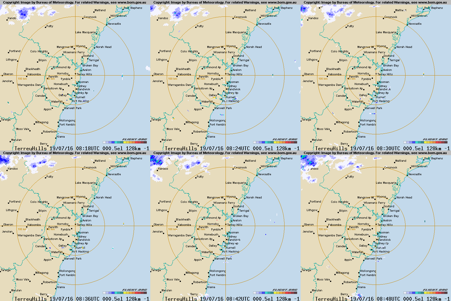
This article serves as an example of social media automation that we can generally develop and deploy for a client in less than a day - sometimes in just a few hours. This particular example demonstrates how we manufacture radar animations from the Australian Bureau of Meteorology  and then send the resulting image to Twitter. While it won't ever become a particularly active account, it does serve a purpose that hadn't existed until we made it.
■ ■ ■
It was after a series of serious storms causing significant damage that we first saw the need for local weather radar animations. There was an existing account that claimed to offer similar functionality... but it was wanting at best. The curator of the other account simply sent a static image to Imgur and and an external link to Twitter. So, not only did he not upload any kind of image or rendering to Twitter, he linked away from Twitter to a third party website.... defeating the purpose of easy-to-digest information in a Twitter stream.
While the BOM provides vast amounts of data on their website, including that data into your own website in any meaningful way often proves problematic. In fact, even the BOM will often share screencasts of their website (on Twitter and Facebook) rather than creating their own real-time animations. Our solution to the problem was to create our own suite of radar animations using data freely available from the BOM web servers.
The Bureau provides a large number of base slides (via FTP) comprising of data such as topography, locations, roads, rail lines, waterways and localities. In addition, the BOM periodically manufactures slides with primary radar paints. To create a useful animation we simply stitch all the relevant base images together and then overlay the radar paints into an animated GIF. Additionally, we watermark each frame (as Flight  ) as a means of disconnecting our images from the official source.
The result of Sydney's kilometer paint is as follows (not current):

Current radar image at api.flight.org/weather/australia/radar/IDR713.gif 
The base URL of the standard image (as shown above) is as follows:
http://api.flight.org/weather/australia/radar/IDR713.gifHowever, for additional control over how the image is presented we can use a URL structure as follows:
http://api.flight.org/weather/australia/radar/111/00000/IDR711.gifThe addition of 111/00000 to the URL structure permits us to alter the presentation by either removing or adding particular slides. The 1's and 0's correlate to the slides as follows:
1 - topography
1 - location
1 - range0 - catchments
0 - rail
0 - roads
0 - waterways
0 - districts
So, if we were to exclude topography and include the waterways, we would use the URL format as follows (note the /011/01000/):
http://api.flight.org/weather/australia/radar/011/01000/IDR711.gifThe result:

Current radar image at api.flight.org/weather/australia/radar/011/00001/IDR713.gif 
It's against the BOM's terms of service to provide their data to others for reuse so our images shouldn't be used by anybody else. However, if you were interested in a similar service of your own we can could generally provide it within 24 hours.
Other BOM Data
Our API provides virtually all data for every location in Australian, including renderings such as doppler winds and rainfall charts. For example, you can see a 128km Sydney (Terry Hills) Doppler Wind paint here  , 64km Sydney (Terry Hills) radar paint here
  , and the 128 km Sydney (Terrey Hills) 1 hour Rainfalls paint here
  .
.
For readability, our animations (or the time each individual slide displays) are marginally slower than those on the BOM website. We also keep the last frame in focus for a little longer.
Radar Images on Twitter
We've set up a number of accounts that send an animated radar paint directly to Twitter. For example, a Sydney radar animation can be found at @SydneyBasin  . While we don't expect any sort of significant following, it does serve a purpose and it does demonstrate how some of our automated services work.
Radar Images on YouTube
To demonstrate another means of how information might be disseminated, every night we automatically upload 24 hours of weather paints (compressed to 3 minutes) to YouTube. While one of the most pointless YouTube channels we've ever created, and despite the fact it was created to demonstrate some tech, it does keep a running commentary on Sydney's weather patterns for those that are interested.
How You Might Use This Feature
Most of our clients are generally not interested in radar animations. However, the same tech can be applied to sending daily product specials, photographs, or anything else, to Twitter and other social networds. By way of a simple online form (not unlike a contact form) one can send fully formatted animations (with images) quickly and easily. Slowing down the animation speed and adding some eye-catching images is an easy means of increasing the conversion on your tweet.


